Contributors
Aviation Museum (Bucharest)
Dimitrie Gusti National Village Museum (Bucharest)
Teleorman County Museum (Alexandria)
Boian Plain Museum (Drăgănești-Olt)
Ostrovit S.A.
Caro Hotel
Aerial Archaeology. In Romania and in Europe
Aerial survey projects in the eastern part of Belgium
René Pelegrin, Marc Lodewijckx, Luc Corthouts
Abstract
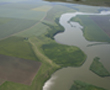
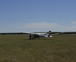
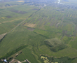
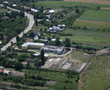
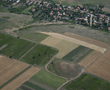
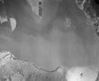
Within the framework of various projects, we were able to execute aerial archaeology since 1997, primarily in the eastern regions of Belgium. With the financial support of the Flemish Government we started with archaeological surveys in the eastern part of Flanders, in teamwork with our colleagues of the University of Ghent who used to concentrate their efforts in the western part of Flanders. In more recent times we flew over Wallonia, first and foremost over the Liège region, in close cooperation with the Archaeological Service of Wallonia. Since July 2010, we above all explore a vast area in the south of central Belgium on demand of the Portiva Regional Archaeological Service, based at Tienen.
Since we started our surveys, our methods have been constantly adapted to new challenges and opportunities, such as digital photography, GPS technology and Google Earth. Our contribution to this workshop is to explain our actual methodology and some of the interesting and occasionally spectacular results that have been brought to light by them.
 |
 |