Contributors
Aviation Museum (Bucharest)
Dimitrie Gusti National Village Museum (Bucharest)
Teleorman County Museum (Alexandria)
Boian Plain Museum (Drăgănești-Olt)
Ostrovit S.A.
Caro Hotel
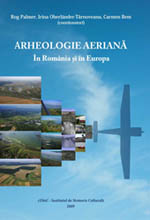
Aerial Archaeology. In Romania and in Europe
AARG 2010 Conference Programme
15 September 16 September 17 September
15 September 2010
Pre-conference workshop:
Remote-sensing mapping programmes in archaeology: planning, organisation, results
The purpose of this workshop is to discuss the utility of multiannual
aerial mapping programmes for archaeology and cultural heritage protection in
European countries. Are they necessary? Or can Google Earth replace them?
What are the costs and benefits? How many people are needed, with what
expertise? How many flights a year? How many sites identified on average
during a flight? How many hours needed to analyse, georeference and
interpret the photos? What about the resulted archives: who get access? What are the maintenance costs? There are many questions people from countries at an early stage in this field put. There is no easy answer but we want to learn about good parts and mistakes to avoid, if possible.
We want to bring together people who participated in such programmes in
their countries, regions and organisations, to learn about their strategy,
planning, workflow, costs and results. Whether you want to speak about your
experience or to put questions, please register for the pre-conference
workshop.
Programme (and presentations)
Rog Palmer |
10:00 – 10:30 |
|
Chris Musson |
Strategy and rates of discovery for sites in Wales and the adjacent parts of England |
10:30 – 11:00 |
René Pelegrin |
11:30 – 12:00 |
|
Ioana Oltean |
12:00 – 12:30 |
|
Visy Zsolt, Szabó, M. Pánczél, Sz. |
Aerial archaeological investigations |
12:30 – 13:00 |
|
Lunch Break and |
13:00 – 15:00 |
Dorel Micle, Adrian Cântar & alli |
Using satellite images to identify archaeological structures in the Banat Region, SW Romania |
15:00 – 15:30 |
Dr. Ralf Hesse |
15:30 – 16:00 |
|
Rog Palmer |
Using Google Earth
|
16:00 – 16:30 |
Peter Horne |
16:30 – 17:00 |
|
|
Discussions |
17:00 – 17:30 |
16 September 2010
09.00 - 09.45 REGISTRATION and COFFEE
09.45 - 10.30 AARG AGM
10.30 - 10.40 WELCOME
|
|||
Irina Oberländer Târnoveanu |
Aerial archaeology in Romania: a glimpse of the last forty years |
10.40 |
|
Bill Hanson |
Aerial reconnaissance for archaeology in Romania (1998-2010) |
10.55 |
|
Ioana Oltean |
The archaeological landscape of Southern Dobrogea (Romania) |
11.20 |
|
Radian Andreescu, Carmen Bem, Katia Moldoveanu |
Tell Settlement Patterns. The Lower Danube in the 5th mil. B.C. |
|
|
Zoltán Czajlik |
Aerial archaeological survey of burial tumuli and earthworks in the Transylvanian plain |
12.10 |
|
Irina Oberländer Târnoveanu, Carmen Bem, Bogdan Șandric |
In Search of past Archaeological Landscapes |
12.35 |
|
13.00 - 14.15 LUNCH |
|||
14.15 - 16.00 AERIAL ARCHAEOLOGY PROJECTS |
|||
|
Claire Goffioul, Rene Pelegrin, Luc Corthouts, Marc Lodewijckx, Jean-Marc Léotard |
Aerial surveys in the Belgian Province of Liège |
14.15 |
| Jeroen De Reu, Machteld Bats, Jean Bourgeois | From aerial photographs to Bronze Age burial landscapes in sandy Flanders (NW Belgium) | 14.40 | |
| Gwil Owen | Aerial Images of Amarna | 15.05 | |
| F. Longo, A. Rossi, A. Santoriello | Aerial Archaeology at Phaistos (Crete) | 15.30 | |
16.00 - 16.30 COFFEE |
|||
Chair: |
|||
| Dave Cowley and Rog Palmer | Interpretation of aerial remote sensing data: best practice? | 16.30 | |
| Véronique De Laet | Automatic versus semi-automatic extraction of archaeological features from High Resolution Satellite Imagery: a state of the art review and future directions | 16.50 | |
| Michael Doneus | Perception | 17.15 | |
| Rog Palmer | One way of teaching |
17.35 | |
| Darja Grosman | Stone and water: interpreting the obvious | 18.00 | |
| A N Other | Discussion | 18.25 | |
Chair: |
|||
| Sarah Davies |
TV and Historians can make more happen together | ||
| Jerzy Tyszkiewicz |
Can Aerial Archaeologists learn from Astronomers? | ||
| Rene Pelegrin | PORTIVA-project | ||
17 September 2010
9.00 - 11.00 LIDAR IN CONTEXT |
|||
Rosa Lasaponara, Nicola Masini |
Investigating deserted medieval villages in Southern Italy using satellite data aerial photos and Laser Scanning |
9.00 |
|
Michael Doneus |
The Impact of Airborne Laser Scanning for Landscape Archaeology |
9.25 |
|
Ralf Hesse |
LIDAR prospection results: spatial patterns and cross-evaluation with known sites |
9.50 |
|
Nicolas Poirier, Rachel Opitz, Laure Nuninger, Ostir, K. |
Lidar integration in a well known archeological context: what is the added value? |
10.15 |
|
|
Rachel Opitz, Laure Nuninger, Catherine Fruchart and Clement Laplaige |
Integrating fieldwalking, geophysics and lidar in the Franche-Comté |
10.40 |
11.10 - 11.40 COFFEE |
|||
11.40 - 13.00 LIDAR IN CONTEXT (CONTINUED) |
|||
Stewart Ainsworth, Matthew Oakey and Mark Kincey |
Miner-Farmer landscapes of the North Pennines Area of Outstanding Natural Beauty (AONB): English Heritage research into extensive lead-mining landscapes
|
|
|
Paolo Forlin |
Solar radiation analysis and automatic feature recognition applied on Lidar data of a medieval silver mine area, Monte Calisio, Trento, Northern Italy |
12.05 |
|
12.50 - 14.00 LUNCH |
|||
Chair: |
|||
| Ioana Oltean, Bill Hanson, Ovidiu Țentea | Aerial archaeology and Roman limes in Romania | 14.00 | |
| Gábor Bertók, Csilla Gáti | An Emerging Late Neolithic Landscape in Baranya County, Hungary - Recent discoveries from the air and from space | 14.25 | |
| Nayden Prahov | Development of Predictive Models for identification of Archaeological Sites along the Bulgarian Black Sea Coast in GIS Environment | 14.50 | |
| A. Morintz, R. Kogălniceanu, C. J. Markussen | Non-intrusive surveying of a prehistoric site (Iepurești, Giurgiu County): from the air, at the ground level, and below the surface | 15.15 | |
| 15.40 - 16.10 COFFEE | |||
Chair: |
|||
| Philippe Fajon | Aerial archaeology and archaeogeography: how to go on working together | 16.10 | |
| Jan Walstra | The environmental context of an ancient site in the Upper Khabur basin (NE Syria) | 16.35 | |
| Gertjan Plets, Jean Bourgeois | Studying the preservation of the Archaeological monuments of the Altay Mountains through landscape and land-use changes | 17.00 |
|
| Ole Risbøl | Retrospective monitoring of a Norwegian pebble-stone beach cemetery using aerial photos and lidar | 17.25 | |
| Rebecca Bennett, Kate Welham, Ross A Hill and Andrew Ford | Multisensor Airborne Remote Sensing Techniques for Archaeological Survey and Interpretation | 17.50 |
|
18 September 2010
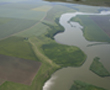
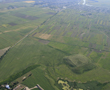
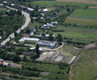
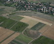
8.00 – 20.00 FIELD TRIP Route: Bucharest – Alexandria – Drăgănești-Olt - Bucharest
POSTERS
Automatic identification methods of linear and circular archaeological structures via satellite imagery processing Dorel Micle, Daniela Zaharie & Oana Borlea
The Linear Earthworks System in Timis County (SW Romania, Banat region) – a synchronic approach Dorel Micle, Liviu Măruia, Marcel Török, Adrian Cîntar, Călin Timoc & Andrei Stavilă
Aerial archaeology and the age of the internet: a survey of free internet-based satellite and aerial imagery for Southern Dobrogea (Romania) John Gates
Using satellite images to identify a possible medieval road in the Vinga High Plains (Banat, România) Dorel Micle, Leonard Dorogostaisky, Liviu Măruia, Marcel Torok, Adrian Cîntar & Lavinia Bolcu
Sub-canopy archaeological prospection of Chopwell Wood, N. England through multiple-echo discrete-pulse laser ranging (LiDAR) Jack Landy
So much to be found! An assessment of the national digital height model in Denmark Esben Schlosser Mauritsen
An integration of airborne LiDAR and vertical aerial imagery to analyze two Iron Age hillforts in Northern Galicia (Spain) João Fonte & Luis Gonçalves-Seco
The potential of archaeological landscape survey through airborne laser scanning (LiDAR) in the Czech Republic Martin Gojda & Lenka Starkova
Airborne remote sensing, LiDAR and the coastal promontory forts of Pembrokeshire: A pilot project Toby Driver & Louise Barker
The search for Koknese fortress front fortifications Juris Urtans
The potential of using relief shaded LiDAR images in detection and investigation of fossil fields in Estonia Helena Kaldre
Towards an Integrated, Multi-method Remote Sensing Strategy for Archaeological Landscape Analysis: the Discovery of the Rosnaree Enclosure, Brú na Bóinne World Heritage Site, County Meath, Ireland Kevin Barton & Conor Brady
Support of lidar advanced data visualisations in past cultural features recovery in vegetated areas: past water streams, bronze age hill forts, past settlements, WW1 trenches and shell craters Žiga Kokalj, Krištof Oštir, Tatjana Veljanovski & Andrej Kobler
Advancement of relief interpretation with sky-view factor in rendering details of past settlement structural elements Žiga Kokalj, Klemen Zakšek & Krištof Oštir
Visualisation tools for ALS Data Nina Heiska, Jakob Ventin & Ilari Kurri
A “Task Force” in aerial imagery in the Public Service of Wallonia: A renewed approach in the management and analysis of aerial Imagery for archaeological purpose in The Walloon Region. Claire Goffioul, for the Aerial Imagery Working Group (SPW)
Air photographic analysis and mapping of the Roman town at Aldborough, North Yorkshire Tara-Jane Sutcliffe
Reconstructing a ritual landscape from the air Peter Halkon
INSPIREd delivery: the development of web map services for aerial photographic transcriptions at RCAHMS. Mark Gillick, Peter McKeague & Alistair Wilkie