Contributors
Aviation Museum (Bucharest)
Dimitrie Gusti National Village Museum (Bucharest)
Teleorman County Museum (Alexandria)
Boian Plain Museum (Drăgănești-Olt)
Ostrovit S.A.
Caro Hotel
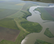
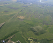
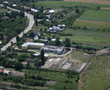
Aerial Archaeology. In Romania and in Europe
AARG 2010
Pre-conference workshop:
Remote-sensing mapping programmes in archaeology: planning, organisation, results
15 September 2010
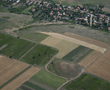
The purpose of this workshop is to discuss the utility of multiannual
aerial mapping programmes for archaeology and cultural heritage protection in
European countries. Are they necessary? Or can Google Earth replace them?
What are the costs and benefits? How many people are needed, with what
expertise? How many flights a year? How many sites identified on average
during a flight? How many hours needed to analyse, georeference and
interpret the photos?
What about the resulted archives: who get access? What are the maintenance costs?
There are many questions people from countries at an early stage in this field put. There is no easy answer but we want to learn about good parts and mistakes to avoid, if possible.
We want to bring together people who participated in such programmes in
their countries, regions and organisations, to learn about their strategy,
planning, workflow, costs and results. Whether you want to speak about your
experience or to put questions, please register for the pre-conference
workshop.
Programme and presentations (pdf)
0 |
Rog Palmer |
10:00 – 10:30 |
|
1 |
Chris Musson |
Strategy and rates of discovery for sites in Wales and the adjacent parts of England |
10:30 – 11:00 |
2 |
René Pelegrin |
11:30 – 12:00 |
|
3 |
Ioana Oltean |
12:00 – 12:30 |
|
4 |
Visy Zsolt, Szabó, M. Pánczél, Sz. |
Aerial archaeological investigations |
12:30 – 13:00 |
|
|
Lunch Break and |
13:00 – 15:00 |
5 |
Dorel Micle, Adrian Cântar & alli |
Using satellite images to identify archaeological structures in the Banat Region, SW Romania |
15:00 – 15:30 |
6 |
Dr. Ralf Hesse |
15:30 – 16:00 |
|
7 |
Rog Palmer |
Using Google Earth is enough?
|
16:00 – 16:30 |
8 |
Peter Horne |
16:30 – 17:00 |
|
|
|
Discussions |
17:00 – 17:30 |
If you are interested to speak about your experience or rise questions, please register for the pre-conference workshop by sending an e-mail to Irina Oberländer-Trnoveanu:
irina @ cimec.ro
There is no registration fee but limited places.